Our Services
GIS Mapping
Well Logs & Seismic - SEGY
Remote Sensing

Hands On Experience in Digitizing Topomap, Geological, Magnetic Contour, City Maps, Raster to Vector Conversion..............
Remote Sensing
Well Logs & Seismic - SEGY
Remote Sensing
Addressing the needs on all verticals like Agriculture, Mining and Exploration, Urban development, Water, Forestry....
Well Logs & Seismic - SEGY
Well Logs & Seismic - SEGY
Well Logs & Seismic - SEGY

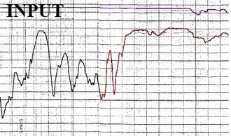
Digitizing Legacy Data of Well Logs and Seismic Images to ASCII, DXF, LAS, & SEG Y
Parcel Mapping
Satellite Derived Products
Well Logs & Seismic - SEGY

Digitizing Parcel data from Legacy Data with Township and Range information, Georeferenced and Attributed Parcel ID with Joined Non-spatial GeoDatabase
Engineering & Lidar
Satellite Derived Products
Satellite Derived Products

Specialized in scanning and converting Drafting Engineering drawings, maps, and other large format documents into digital files
Satellite Derived Products
Satellite Derived Products
Satellite Derived Products

Deriving Land satellite Temperature using Thermal Infrared, The Land Surface Temperature (LST) is the radiactive skin temperature of ground
Derived Products, Minerals & Ground Water
Magnetic Contour Mapping
Magnetic Contour Mapping
Magnetic Contour Mapping

Having tremendous experience Digitizing Magnetic Contour maps and compile and creating seamless data for the Global level dataset..
Well Log & LithoLogs
Magnetic Contour Mapping
Magnetic Contour Mapping
Digitized nearly 2000 Well logs with Gama, Caliper Ray, Bulk Density into ASCII, DXF and SEGY formats..
Seabed Classification
Magnetic Contour Mapping
Seabed Classification
Seabed classification is one route to characterizing the seabed and its habitats. makes the link between the classified regions and the seabed physical, geological, chemical or biological properties
Mineral Mapping
Seabed Classification
Satellite image products and services that may incorporate specialized processing procedures for mineral mapping and geological interpretation, Forestry, LandUse, Coastal Resources.. Contact us...
Satellite Derived Ground Water
We are proud to announce that we could derived satellite derived Ground water resources using Geophysical and Geological Interpretation services using Remote Sensing Technology
Lidar
Lidar point can have a classification assigned to it that defines the type of object that has reflected the laser pulse. Lidar points can be classified into a number of categories including bare earth or ground, top of canopy, and water